
Viindoo Unified Routing Framework
| Lines of Code | 4118 |
| Technical name | to_geo_routes |
| License | OPL-1 |
| Website | https://viindoo.com/apps/modules/19.0/to_geo_routes |
| Read description for | v 10.0 v 11.0 v 12.0 v 13.0 v 14.0 v 15.0 v 16.0 v 17.0 v 18.0 |
| Required Apps | Discuss (mail) |
| Included Dependencies | Viindoo Base API Request Logger |
| Extensions | Tracking Location Route Extension Freight Forwarder Management Fleet Operations SeaRoutes Ocean Routing Integration Logistics Routes Integration Mapbox Matrix API Integration Google Maps Directions & Distance Matrix API Integration HERE Routing API Integration Route Cost & Revenue Accounting Vietmap Matrix & Routing API Integration |
Know the distance and travel time of every route before the trip starts
For operations, fleet and logistics teams that plan trips between addresses
Plan routes through ordered stops and get their distances, travel times and directions from the map provider you choose.
Odoo 19.0 · Community and Enterprise · OPL-1
What changes for your team
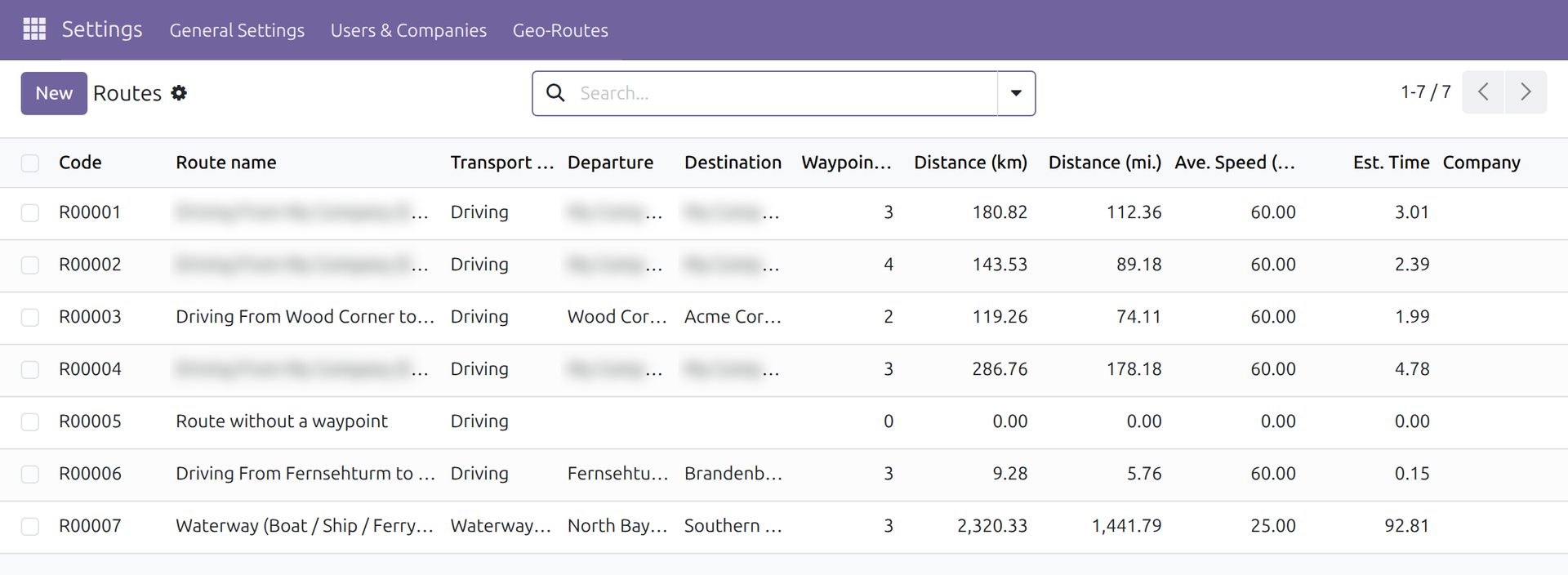
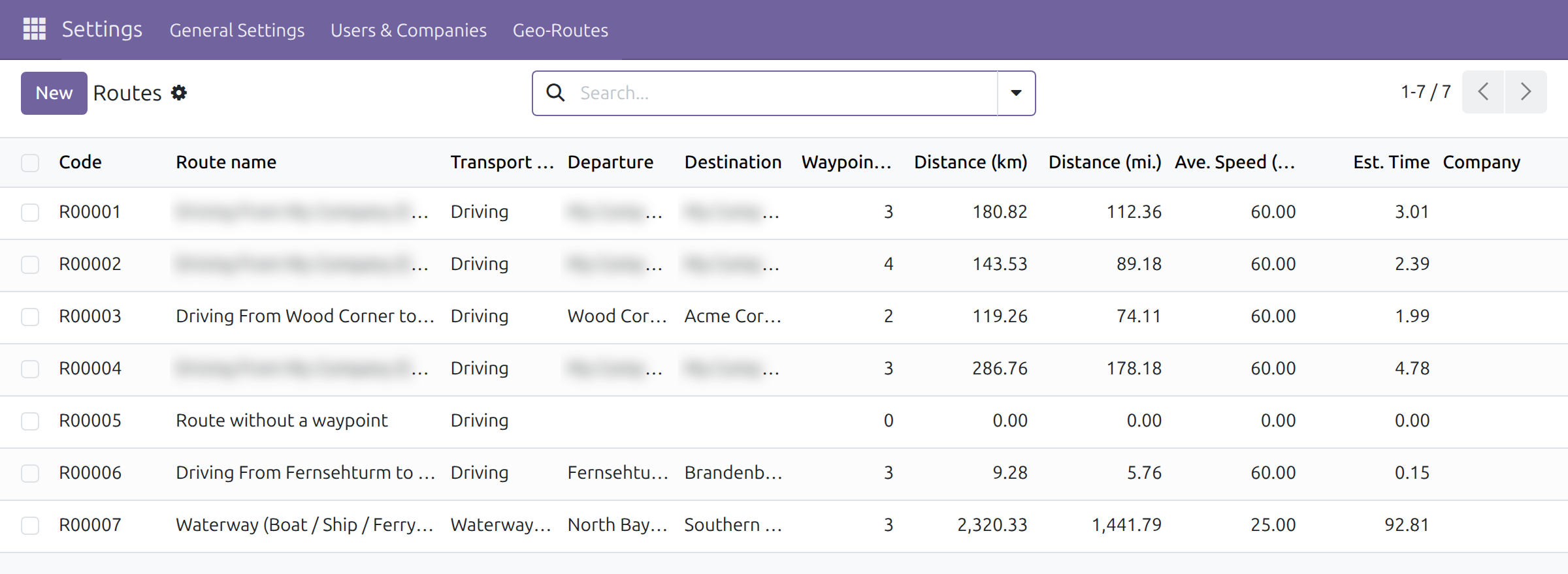
Every route is measured the moment it is saved
Today a planner looks up each leg on a map site and copies the figures into a spreadsheet.
→ List the stops and pick a transport mode: the route shows its departure, destination, total distance, average speed and estimated time. One click reorders the stops to shorten the trip.
One distance per pair of addresses, shared by every route
Today the same leg is measured again for each trip, and two applications can disagree on it.
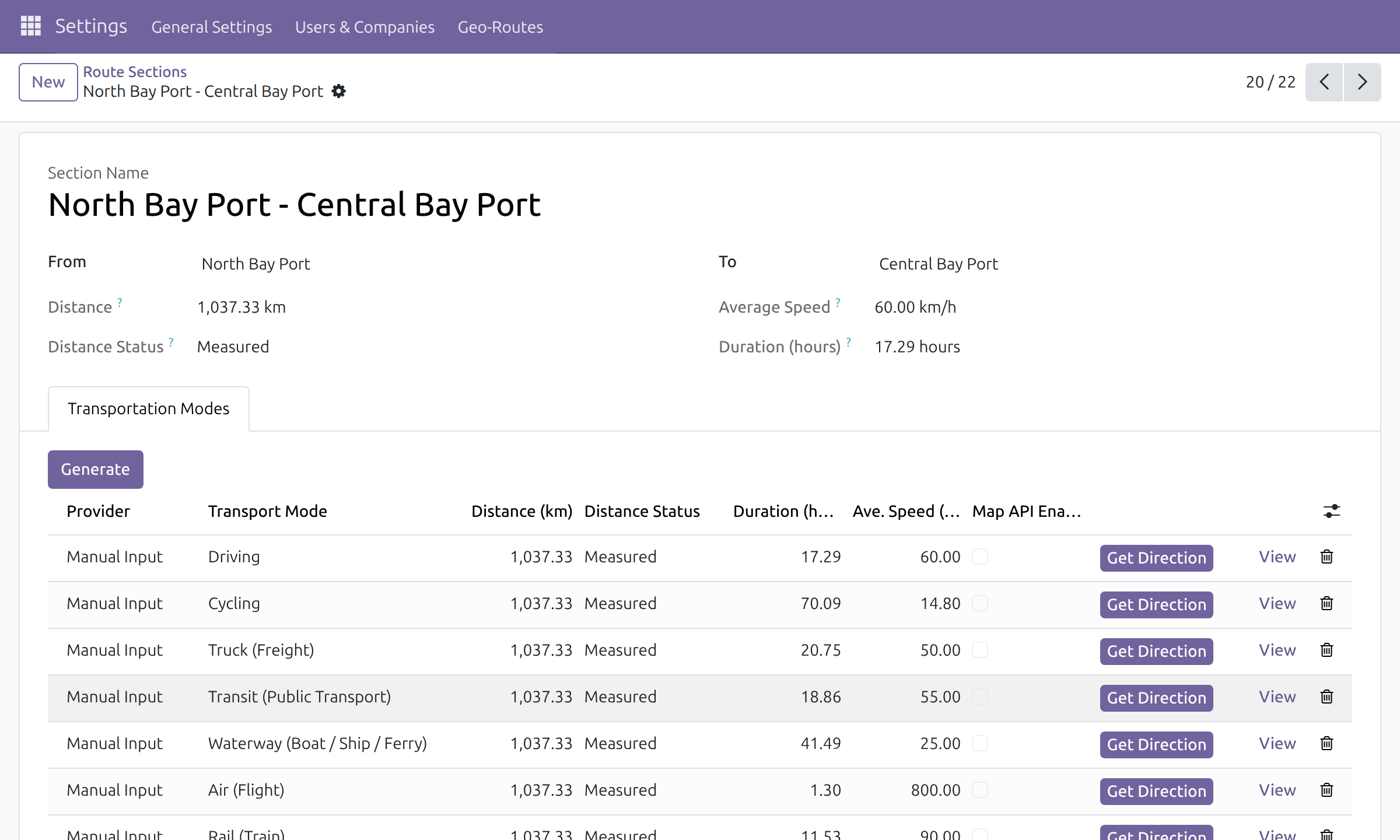
→ The distance and time between two addresses are kept once per transport mode and provider, and every route through that leg reuses them. A status beside each figure says why it is shown, for example measured, or an address without coordinates.
Useful estimates before any map subscription
Today a routing project starts with choosing and integrating a map service.
→ Out of the box, distances come from the coordinates of the addresses and a typical speed per transport mode. When a map service add-on is activated, its figures take over for the modes it covers, and the routes stay as they are. If a provider fails, the next one for that mode is tried.
Ready on day one
Transport modes with typical speeds
Driving, cycling, truck, public transit, waterway, air and rail, each with an editable average speed.
Kilometers or miles
Each company chooses the unit its distances and speeds are shown in.
Areas for your addresses
Group addresses into a hierarchy of areas, optionally restricted to one state or country.
Set up first
Give your addresses coordinates, choose the distance unit and, if needed, activate a map service.
What is included
Routes, shared route sections, address areas, transport modes, estimates and stop reordering. Map services and trip planning are optional add-ons.
Optional extensions
Fleet Operations
Plan trips on these routes, dispatch vehicles and guide drivers from one place.
Route Cost & Revenue Accounting
Link routes with analytic accounts and invoices to see cost and revenue per route.
Google Maps Directions & Distance Matrix API Integration
Road distances, travel times and paths for driving, cycling and transit.
HERE Routing API Integration
Routing and distances for car, bicycle and truck trips, and public transit.
Mapbox Matrix API Integration
Distance tables and routing for fleet and delivery planning.
SeaRoutes Ocean Routing Integration
Ocean routes, distances and durations for maritime legs.
Before you decide
Does any of our data leave the database?
Not without a map service add-on: estimates are computed from the coordinates stored on your contacts. With an add-on, the stops of a route are sent to that service, and its requests are recorded in the system's API request log.
Do we need a paid map service?
No. Without one, distances are straight-line distances between coordinates, so a road trip is usually longer than shown; you can correct a segment by hand. A map service add-on uses your own account with that service and gives road figures.
Who can see and change routes?
Every internal user can read routes, sections and areas. Users with the Geographical Routes / User right create and edit them; Geographical Routes / Administrator can also delete routes. The menus sit under Settings, for administrators.
Which languages does it ship in?
English and Vietnamese.
What does it take to run or extend it?
The server needs the Python libraries ortools and polyline. Developers add a map service by implementing one standard interface for directions and distance tables; nothing built on it changes.
Try it, then ask us
Read the Documentation tab, open the Live Preview or watch the video above.
Pre-sales & partnership
viindoo.com/contactusTechnical support
viindoo.com/ticketTechnical requirements
- Odoo version: 19.0
- Editions: Community, Enterprise
- Required modules: Discuss, Viindoo Base, Partners Geolocation, API Request Logger
- Python libraries: ortools, polyline
- License: OPL-1
- Languages: English, Vietnamese
Unified Routing Framework
Note
This guide is for administrators and for the people who plan routes: it explains how to define routes, keep their distances and travel times accurate and choose the unit they are shown in.
Overview
Unified Routing Framework gives the system one way to describe a route and to measure it: the stops a vehicle passes through, the distance and travel time between each pair of stops, and the transport mode used. Business applications such as fleet planning, booking or delivery build on it, so every one of them shows the same routes and the same figures.
Out of the box the distances come from the coordinates of the stops (straight-line distance) and a typical speed per transport mode. When a routing provider is activated in the settings, its figures replace the estimate for the transport modes it covers.
The work is done in these stages:
- The administrator checks the transport modes and, when wanted, activates a routing provider and chooses the distance unit.
- The administrator (or a planner with the same access) lists the stops of each route. The route name, departure, destination, distance and estimated time are filled in automatically.
- The administrator refreshes the distances or reorders the stops when the figures need to be recomputed.
| Role | What they do | Access right to assign |
|---|---|---|
| Administrator | Installs the module, chooses the distance unit, activates routing providers, maintains routes, sections and areas. | Role / Administrator |
| Route planner (through the other applications) | Creates and edits routes, sections, waypoints and areas in the applications that build on this module. | Geographical Routes / User |
| Route supervisor (through the other applications) | Does the same and also deletes routes. | Geographical Routes / Administrator |
Every internal user can read routes, sections and areas. The Geo-Routes menu itself sits under Settings, so it is reached by users who can open Settings; other applications offer their own entry to the same data.
Setup (for the Administrator)
Installation
- Open Apps, search for Unified Routing Framework and click Install.
- The module needs two Python libraries on the server, ortools and polyline. Ask whoever hosts the system to install them before the module is installed.
Choose the distance unit
- Open Settings ‣ General Settings.
- In the Distance Unit block choose Kilometers or Miles.
- Click Save.
Routes, sections and providers then show kilometers (km, km/h) or miles (miles, mph) for the company.
Activate a routing provider (optional)
Without a provider, distances are estimated from coordinates. To use a map service instead:
Open Settings ‣ General Settings and scroll to Geographical Distance and Route Optimization.
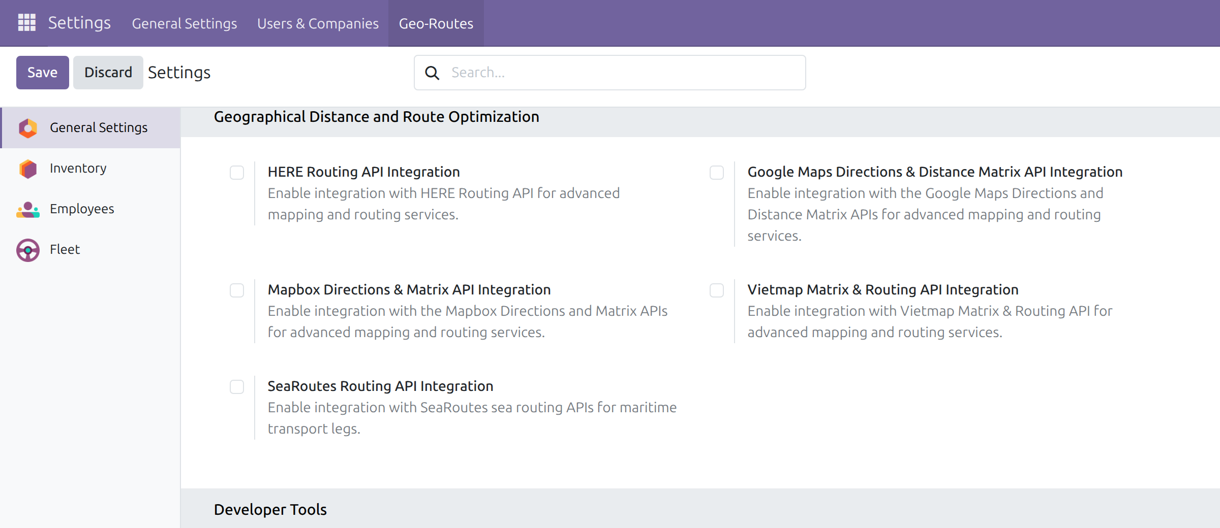
Tick the provider you want: HERE, Google Maps, Mapbox, Vietmap or SeaRoutes. Each provider is a separate add-on; a provider that is not available on your system shows a link to learn more instead of a tick box.
Click Save, then come back to this page to enter the provider's own settings.
Note
SeaRoutes covers maritime legs.
Find the menus
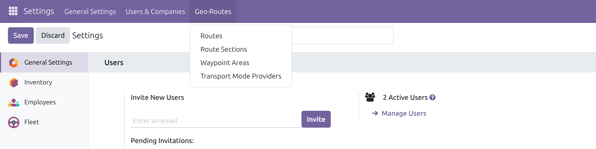
All the screens below are under Settings ‣ Geo-Routes: Routes, Route Sections, Waypoint Areas and Transport Mode Providers.
Administrator: maintain routes and distances
Review the transport modes
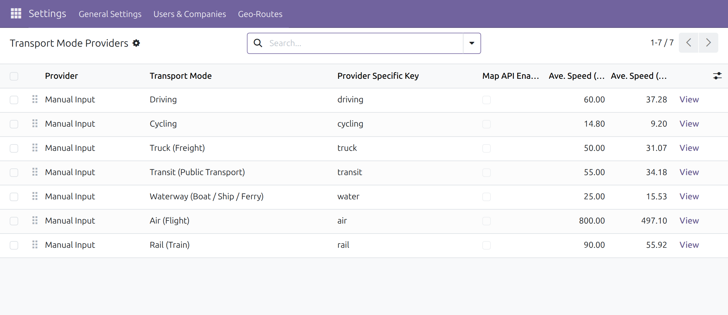
- Open Settings ‣ Geo-Routes ‣ Transport Mode Providers.
- Each line pairs a transport mode (Driving, Cycling, Truck, Transit, Waterway, Air, Rail) with a provider. Manual Input lines are always available and carry the typical speed used for estimates.
- To change a typical speed, edit Average Speed on the Manual Input line of that mode. The speed of a line whose Map API Enabled box is ticked comes from the provider and cannot be edited.
Create a route
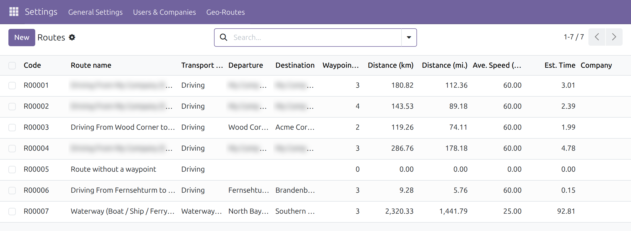
- Open Settings ‣ Geo-Routes ‣ Routes and click New.
- Choose the Transport Mode.
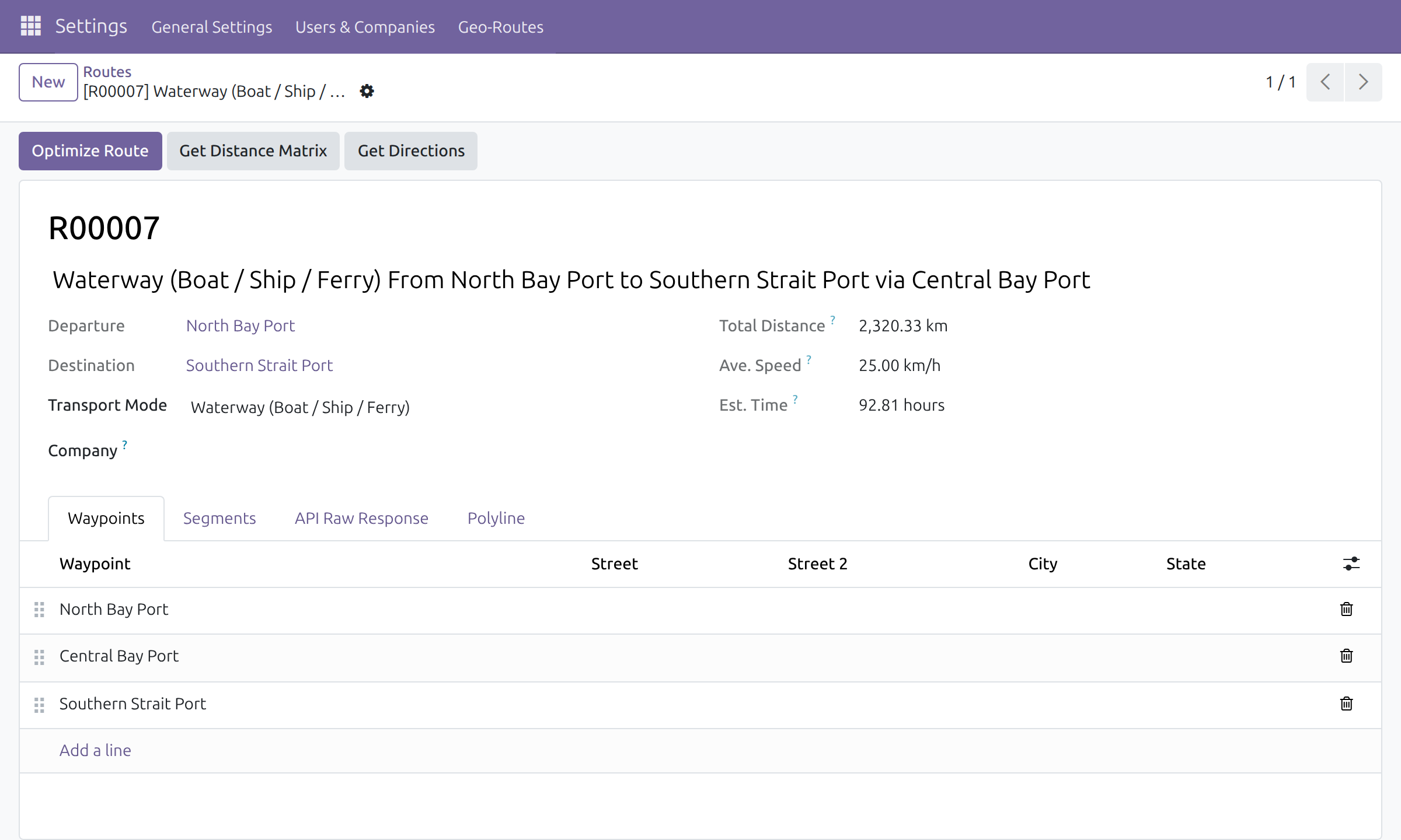
- In the Waypoints tab click Add a line and pick the address of each stop in the order they are visited. Drag the handle at the start of a line to reorder.
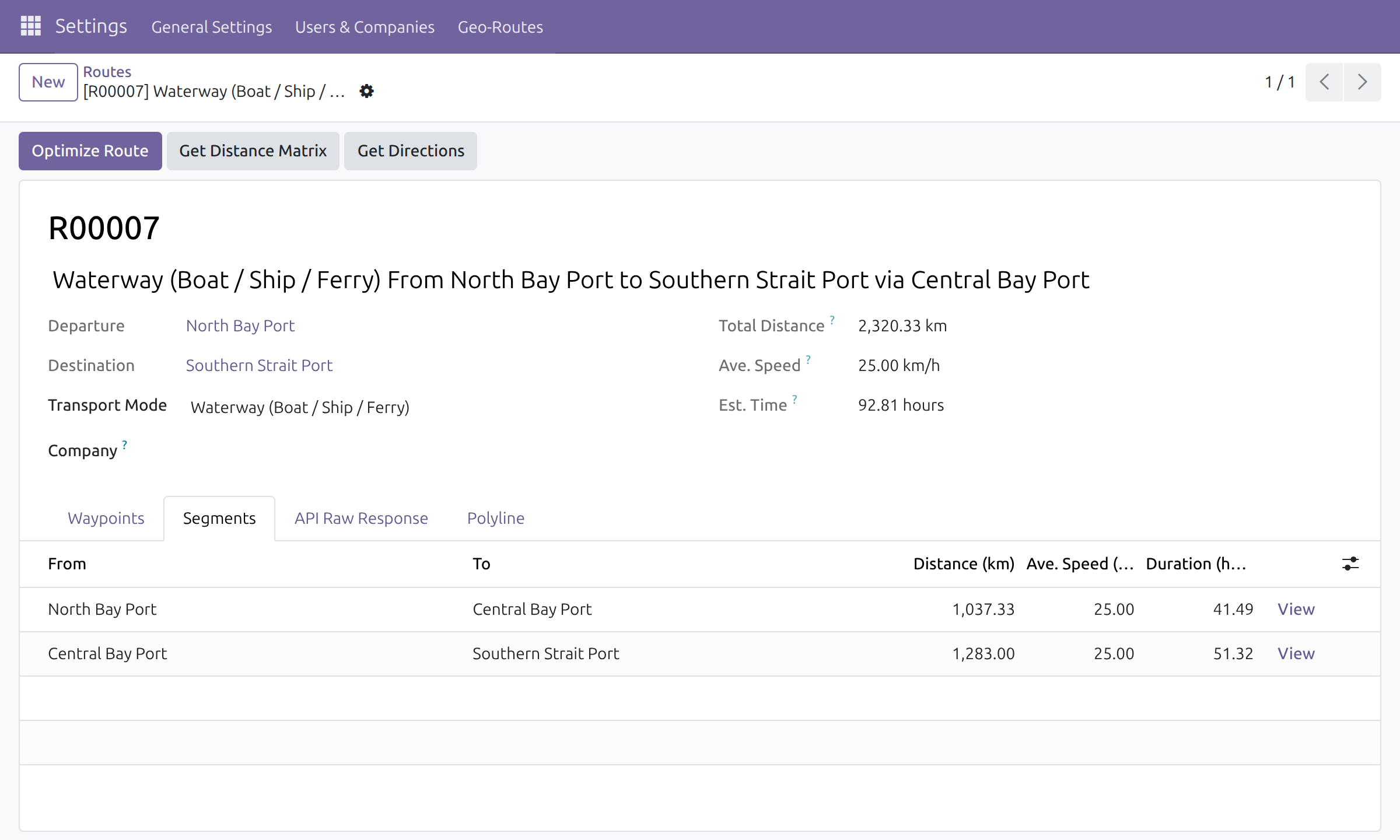
- Save. The code (for example R00007), the route name, Departure (first stop), Destination (last stop), the segments, Total Distance, Ave. Speed and Est. Time are filled in automatically.
The route name reads "<transport mode> From <first address> to <last address>", with "via <address>" added when a stop lies in between. It is written in the language of the user who creates the route, so the transport mode and the words around it never mix languages, and it is kept as written for every other user. A long name wraps in the title of the form and is shown in full.
A few rules apply to the stops:
- Two consecutive waypoints cannot be the same address. A stop that is visited twice must have another stop between the two visits, and a round trip may start and end at the same address.
- A route cannot have the same list of stops and the same transport mode as another route; the message names the existing route.
- A route cannot be duplicated.
- Each address can be linked to a Waypoint Area (see below) from the contact form.
Adjust a segment
Each pair of consecutive stops is one segment. Open the Segments tab to see the distance, average speed and duration of each one. Segments are created and removed for you when you change the waypoints. Edit Distance or Ave. Speed in a line to correct a figure; the duration and the route totals follow. When a provider covers the route's transport mode, its figures take precedence over a value typed here.
Recompute a route
The buttons in the header of a route work on its stops:
- Optimize Route reorders the stops to shorten the trip and updates the segments. A route with fewer than two waypoints is left unchanged.
- Get Distance Matrix asks the available providers for the distances between the stops.
- Get Directions fetches the distance, duration and path of the route. When an address has no valid coordinates the action stops with a message and nothing is saved: complete the address, then try again.
The message "No Geo-Direction Provider enabled" means that no provider is available for the route's transport mode.
Work with route sections
A route section is the distance and time between two addresses, shared by every route that goes from one to the other.
- Open Settings ‣ Geo-Routes ‣ Route Sections and open a section.
- The Transportation Modes tab holds one line per provider and mode, with its distance, Distance Status (for example Measured), duration and speed.
- Click Generate to create the missing lines, or Get Direction on a line to refresh it.
Group addresses in waypoint areas
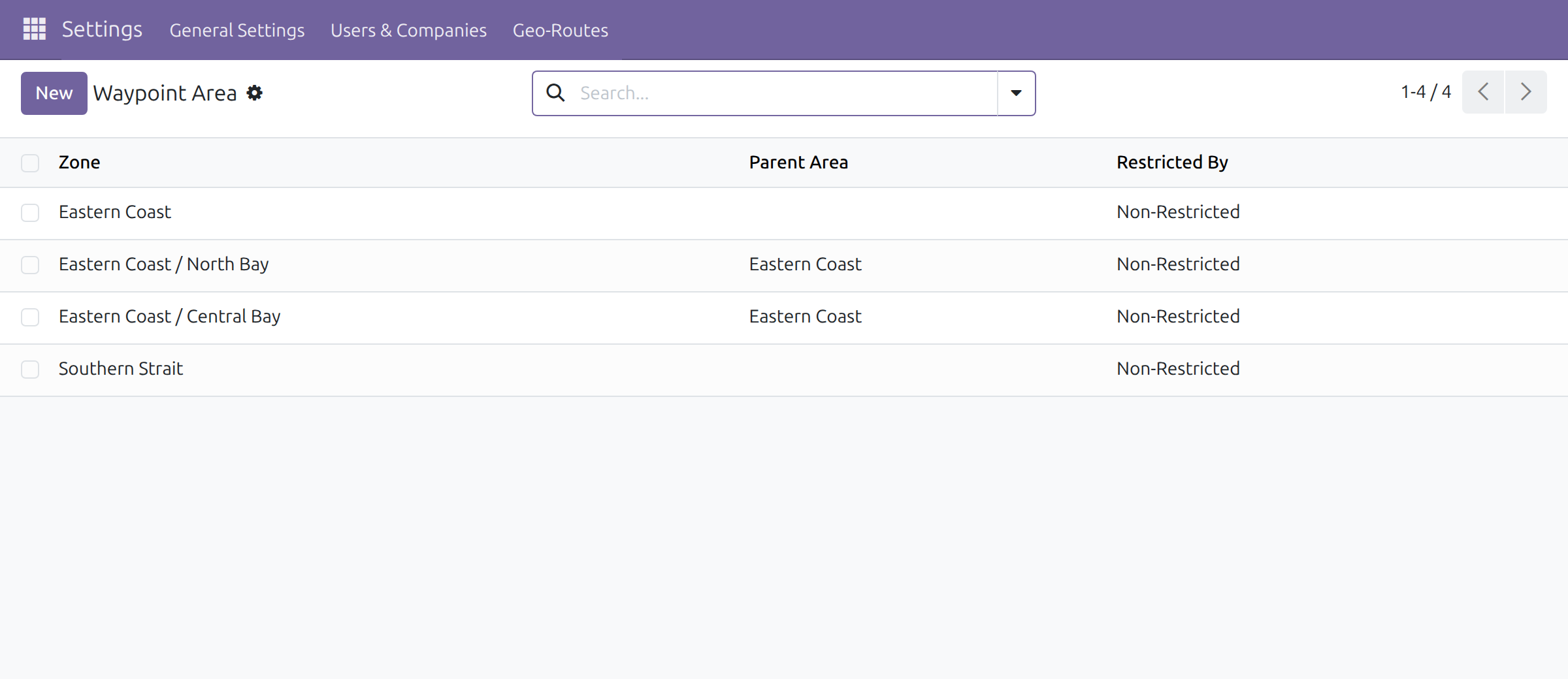
Waypoint areas group addresses by zone, for example a coast and the bays on it.
- Open Settings ‣ Geo-Routes ‣ Waypoint Areas and click New.
- Enter the Waypoint Area name, an optional Parent Area and Restricted By: Non-Restricted, State or Country. A restricted area accepts only addresses of the same state or country.
- On a contact, choose the area in the Waypoint Area field.
This software and associated files (the "Software") may only be used (executed, modified, executed after modifications) if you have purchased a valid license from the authors, typically via Odoo Apps, or if you have received a written agreement from the authors of the Software (see the COPYRIGHT file).
You may develop Odoo modules that use the Software as a library (typically by depending on it, importing it and using its resources), but without copying any source code or material from the Software. You may distribute those modules under the license of your choice, provided that this license is compatible with the terms of the Odoo Proprietary License (For example: LGPL, MIT, or proprietary licenses similar to this one).
It is forbidden to publish, distribute, sublicense, or sell copies of the Software or modified copies of the Software.
The above copyright notice and this permission notice must be included in all copies or substantial portions of the Software.
THE SOFTWARE IS PROVIDED "AS IS", WITHOUT WARRANTY OF ANY KIND, EXPRESS OR IMPLIED, INCLUDING BUT NOT LIMITED TO THE WARRANTIES OF MERCHANTABILITY, FITNESS FOR A PARTICULAR PURPOSE AND NONINFRINGEMENT. IN NO EVENT SHALL THE AUTHORS OR COPYRIGHT HOLDERS BE LIABLE FOR ANY CLAIM, DAMAGES OR OTHER LIABILITY, WHETHER IN AN ACTION OF CONTRACT, TORT OR OTHERWISE, ARISING FROM, OUT OF OR IN CONNECTION WITH THE SOFTWARE OR THE USE OR OTHER DEALINGS IN THE SOFTWARE.